Reality Capture
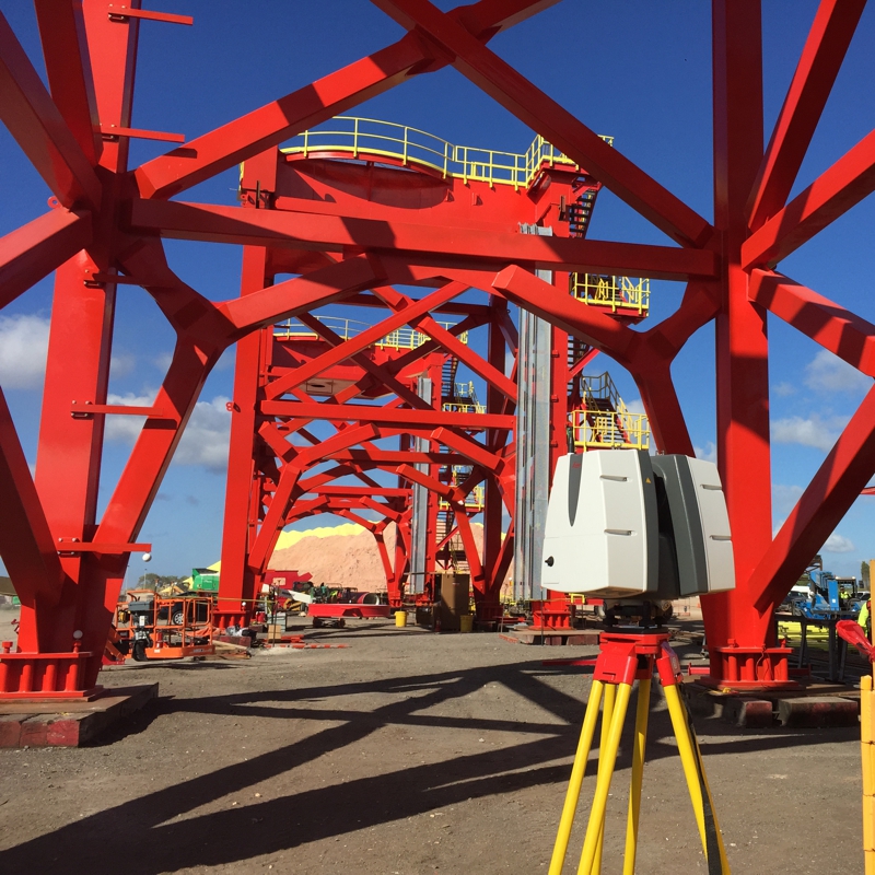
Fast 3D collection of accurate, high-resolution data provides solutions for a variety of architectural, civil, transportation, industrial, commercial, and energy applications. With LiDAR as an available service option, ROWE professionals provide the right solution that works best for each client.
Services
- 3D Object Modeling
- 3D Site Point Clouds
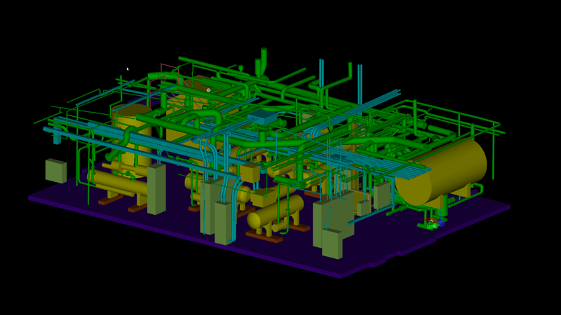
- BIM and Industrial Modeling
- Structural Modeling
- Point Cloud Classification and Analysis
- Mesh Modeling and Reverse Engineering
- Terrain Modeling and Contouring
- Dimensioned Exhibits
- Building Forensics
- Monitoring
- Volumes
 |
Michael Pfaff, has worked nationally in the survey and mapping industry since 1998 with a degree in Surveying Sciences. Spending the first 10 years of his career in conventional surveying projects and construction surveys, in 2008 he focused his career specifically on remote sensing through LiDAR and imaging. Mike is an active FAA certified sUAS remote pilot, certified thermographer, and photographer and serving as ROWE Professional Service Company's Remote Sensing Project Coordinator. Career project types vary from building information modeling (BIM), civil, monitoring and analysis, fabrication and constructability, reverse engineering, visualization, historic preservation, and forensics. As an active professional in this field, he deploys technologies in interesting and practical ways. | |
 |
Dan Payne, spent 8 years in the manufacturing industry as a Process Engineer. He attended Schoolcraft Community College and studied Computer Aided Drafting and Design, specializing in manufacturing processes and 3D modeling. Dan has experience in multiple CAD software's including MicroStation, Catia, Solidworks, NX (formerly known as Unigraphics), Keycreator, AutoCAD, and Revit. In addition, he also has experience using Datem Summit Evolution supporting photogrammetry projects. Dan is an active FAA certified sUAS remote pilot and serves as ROWE Professional Service Company's sUAS Pilot for the Marketing Department and as a Survey Office Technician. | |
 |
Samantha Taylor, began her career in surveying in 2019 when she was hired by ROWE Professional Services Company as a Survey Office Intern. She continued working part-time and eventually began full-time in January of 2020 while she finished her last semester of schooling at Delta College. During her schooling, she was trained in Autodesk AutoCAD, SolidWorks, and various machining software. Samantha earned her Computer Aided Drafting (CAD) Advanced Certificate, Computer Numeric Control (CNC) Certificate of Achievement and an associate degree in general studies. In the last four years, Samantha has worked on an array of survey projects within AutoCAD Civil 3D. Some of these projects include topographic surveys, ALTA surveys, certified surveys, site plans, as-built sites and pipelines and wind and solar farms. |
| Active Memberships: | |
| Michigan Historic Preservation Network |  |
| US Institute of Building Documentation |  |